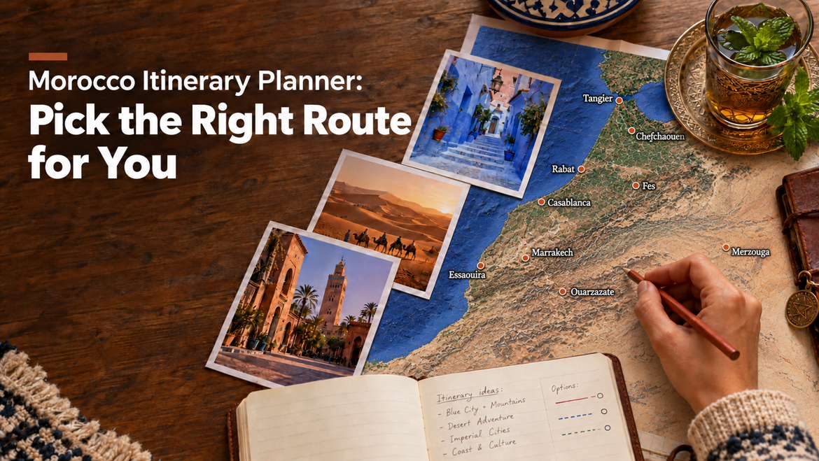
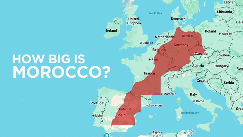
How big is Morocco? Bigger than most travelers expect. Morocco covers 712,550 square kilometers, and the places most visitors want to see, from the blue streets of Chefchaouen to the dunes of Merzouga, sit hours apart on mountain roads. Knowing the real driving times between cities is the key to planning a trip that feels relaxed instead of rushed. If you are comparing routes, our Morocco itinerary planner shows how these distances fit into trips from 3 to 14 days.
1. Morocco at a Glance
- Total area: 712,550 square kilometers
- Main ways to travel: private driver, rental car, train and bus
- Trains: connect Tangier, Rabat, Casablanca, Fes and Marrakech, but do not reach the Sahara, the Atlas Mountains or the valleys
- Roads: highways link the main cities, and mountain roads take you to the desert and the valleys
2. Distance & Travel Time Between Major Cities
Here is a table to illustrate the kind of distances and approximate travel times between some of the key destinations. These are order-of-magnitude estimates to help your clients understand the scale.
| Route | Approx. driving distance | Approx. driving time* | Notes |
|---|---|---|---|
| Casablanca to Rabat | ~90 km | ~1h30 | Easy train ride (~1 hr) |
| Casablanca to Marrakech | ~240 km | ~2.5 to 3 hrs | Train available (~2.5 hrs) |
| Casablanca to Fes | ~295 km | ~3.5 to 4 hrs | Train available (~4 hrs) |
| Casablanca to Chefchaouen | ~340 km | ~5.5 to 6 hrs | Via Rabat and Kenitra; no direct train |
| Chefchaouen to Volubilis | ~164 km | ~3 hrs | Roman ruins on the way to Fes |
| Volubilis to Meknes | ~30 km | ~1 hr | Short drive between two sights |
| Meknes to Fes | ~62 km | ~1 hr | Highway; train also available |
| Fes to Chefchaouen | ~200 km | ~4 hrs | Bus or private car; no train |
| Fes to Aguelmame Sidi Ali | ~135 km | ~2h25 | Lakeside stop to break the drive south |
| Marrakech to Fes | ~530 km | ~6 to 7 hrs | Train via Casablanca (~7 hrs) |
| Marrakech to Chefchaouen | ~570 km | ~8 to 9 hrs | Best split with an overnight stop |
| Marrakech to Agadir | ~250 km | ~3 hrs | Highway; no train |
| Marrakech to Ouarzazate | ~195 km | ~4 to 4.5 hrs | Scenic drive over the Tizi n’Tichka pass |
| Ouarzazate to Merzouga | ~370 km | ~6 to 7 hrs | Via Tinghir and Erfoud |
| Merzouga to Dades | ~265 km | ~4h30 | Via the Todra Gorge |
| Dades to Ouarzazate | ~140 km | ~2h20 | Through the Valley of Roses |
| Marrakech to Merzouga | ~560 km | ~9 to 10 hrs | Never in one go; stop overnight in the Dades Valley |
| Marrakech to Dakhla | ~1,200 km | ~15 to 16 hrs | Far south, outside the classic routes |
| Casablanca to Dakhla | ~1,370 km | ~19 to 20 hrs | Far south, outside the classic routes |
Driving times come from Google Maps and do not include stops. Real travel days take longer, because mountain roads are slow and every route passes villages, kasbahs and viewpoints worth a break. Want to spend less time in the car? Read Slow Morocco.
3. Travel Tips for Planning Your Route
- Plan one long drive at a time. Avoid back-to-back long driving days, and break the longest legs with an overnight stop.
- Never do Marrakech to the Sahara and back in one go. It is about 10 hours on mountain roads each way. Stop for a night in the Dades Valley on the way, and in Ouarzazate on the way back.
- Use the train between the big cities only. It is comfortable between Casablanca, Rabat, Fes and Marrakech, but you will need a car for the desert and the mountains.
- Think twice before driving yourself. Mountain passes, medina parking and navigation take real effort. Our guide to driving in Morocco explains what to expect.
- Let someone else drive. With a private driver and guide, the long road days become part of the trip instead of a chore.
Morocco rewards travelers who plan around its size. Tell us your dates and the places you want to see in the form below, and we will build a route with comfortable driving days and the right stops along the way. You can also follow our trips on Instagram.